
Standard Navigation, 12 Northern Lake Champlain - Burlington to Richelieu, Easy-to-Read, Waterproof Paper, Tear Resistant, Printed on two sides, 2 charts in 1, NOAA ChartsRiver
Product details
| Management number | 215119797 | Release Date | 2026/04/12 | List Price | $15.60 | Model Number | 215119797 | ||
|---|---|---|---|---|---|---|---|---|---|
| Category | |||||||||
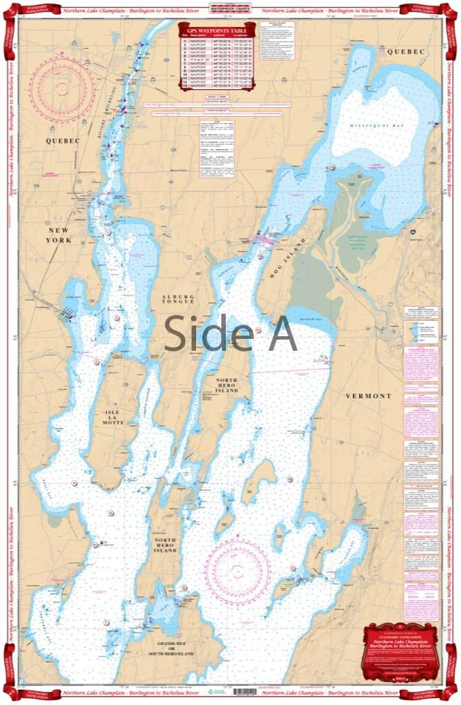
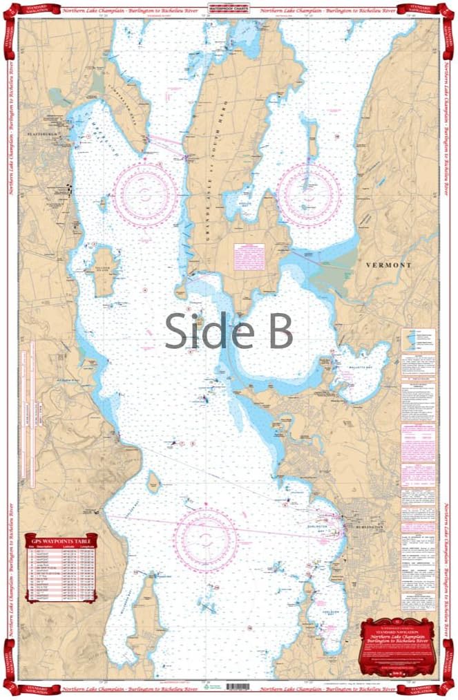
Starting at Willsboro and Shelburne Points coverage is north to and including Missisquoi Bay and the Rt 202 Bridge on the Richelieu River in Canada. Includes Malletts Bay and all of the Champlain Islands. When you’re headed out on Lake Champlain, you’ll need this marine map. C’mon trust us! You won’t find a more detailed nautical map than this. Or a more eye-catching one, you will want to frame this and hang it in your home or office. Starting at Willsboro Point and Shelburne Point coverage is north to and including Missisquoi Bay and the Route 202 Bridge on the Richelieu River in Canada. This navigation chart also includes Malletts Bay and all of the Champlain Islands. This is a great complement to our southern Lake Champlain map #11. Information from 2 NOAA Charts 14782 and 14781. WGS84 / World Mercator Datum. 25" x 38" Easy-to-Read Large Print Waterproof Paper Tear resistant Paper (Indescribable) Printed on two sides - 2 charts in 1: Larger Area of Coverage Charts are Compiled From Several NOAA Charts & Local Information
- Starting at Willsboro and Shelburne Points coverage is north to and including Missisquoi Bay and the Rt 202 Bridge on the Richelieu River in Canada.
- Includes Malletts Bay and all of the Champlain Islands. When you’re headed out on Lake Champlain, you’ll need this marine map.
- C’mon trust us! You won’t find a more detailed nautical map than this. Or a more eye-catching one, you will want to frame this and hang it in your home or office.
- Starting at Willsboro Point and Shelburne Point coverage is north to and including Missisquoi Bay and the Route 202 Bridge on the Richelieu River in Canada.
- This navigation chart also includes Malletts Bay and all of the Champlain Islands.
| UPC | 740399001201 |
|---|---|
| Map Type | North America |
| Brand Name | Waterproof Charts |
| Manufacturer | Waterproof Charts |
| Item Dimensions L x W | 38"L x 25"W |
Bestseller ranking
Public Speaking

Customers who viewed this product also viewed
Marine GPS Chartplotters


Correction of product information
If you notice any omissions or errors in the product information on this page, please use the correction request form below.
Correction Request Form